Clark B. “Bud” Hall is a historian and preservationist who has written widely on the role of cavalry in the American Civil War. In 2012 he received the Civil War Trust’s “Lifetime Achievement Award,” in recognition of his 25-year efforts to protect America’s hallowed ground. He is an expert in the history of the Civil War in Culpeper County and is a frequent contributor of articles on local history to the Culpeper Star Exponent. Hall shared the map below with the following comments:
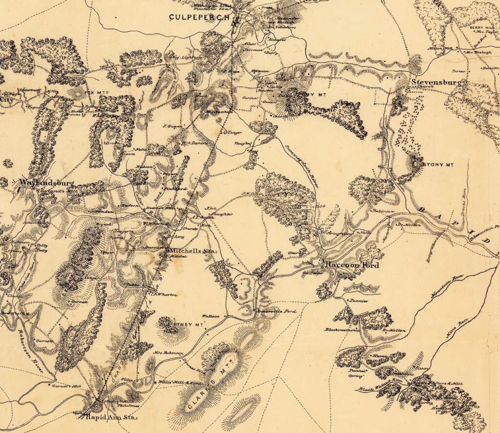
This 1864 map by Captain William H. Paine depicts the still-pristine territory along the Rapidan River near Raccoon Ford. On the lower left, the confluence of the Rapidan and Robinson (Horseshoe) rivers is seen just beneath “Garnett’s Mill.” Fifteen miles to the east, downriver, Mine Run enters the Rapidan.
In the center-right of this superb military map, Raccoon Ford is shown in bold script by the mapmaker and he did that for the ample reason that Raccoon Ford is the single most significant ford on the Rapidan Front.
Note the mapmaker has highlighted Robinson (now Struan); Nalle (now Greenville); and Stringfellow (Summerduck) – all historic properties that continue to thrive in the Raccoon Ford area. Morton’s Ford, site of a February 1864 battle, is situated just beneath Robinson.
The officer who created (and field-checked) this map, Captain William Paine, was the top mapmaker in the Army of the Potomac. After the Civil War, Captain Paine, an engineer, built the Brooklyn Bridge.
Editor’s note: For more about William Paine, please see http://www.petersburgproject.org/william-h-paine-cartographer.html